Scan to BIM Services in Bangalore: How LiDAR Mapping
Agencies Support Accurate 3D Modeling in South India
In the fast-growing construction, infrastructure,
architecture, and real estate sectors, accuracy has become
one of the most important factors in project planning and
execution. Whether it is a commercial building, industrial
facility, hospital, residential apartment, road project,
airport-related survey, or renovation of an existing
structure, every successful project begins with reliable
site data. This is where Scan to BIM Services in Bangalore
play a major role.
Bangalore is one of India's most active construction and
infrastructure hubs. With rapid urban development,
redevelopment projects, industrial expansions, metro
connectivity, commercial spaces, and smart infrastructure
requirements, there is a growing demand for accurate
digital building documentation. Traditional measurement
methods are still useful in many cases, but complex
structures, large sites, and renovation projects require
faster, more detailed, and more precise documentation.
Scan to BIM helps bridge this gap by converting real-world
site conditions into intelligent digital 3D models.
Precision Surveys Pvt. Ltd., a professionally managed
surveying company based in Bangalore, has been serving the
civil engineering industry since 1995. The company offers
land surveying, geotechnical investigation, LiDAR
services, DGPS surveys, topographical surveys,
photogrammetric surveys, measured drawings, alignment
surveys, and related engineering survey solutions. Their
website highlights over 29 years of experience in diverse
land and geotechnical projects and lists LiDAR Survey as
one of their key services.
For project owners, architects, civil engineers,
structural consultants, MEP consultants, and contractors,
Scan to BIM is not just a digital modeling service. It is
a smarter way to reduce site errors, avoid rework, improve
coordination, and make better construction decisions.
What Are Scan to BIM Services?
Scan to BIM is a process where a physical building, site,
plant, or infrastructure asset is scanned using advanced
laser scanning or LiDAR technology, and the captured data
is converted into a Building Information Model. The
scanning process produces a highly accurate point cloud,
which is then used to create a detailed 3D BIM model.
In simple terms, Scan to BIM means converting real site
conditions into a digital 3D model that can be used for
planning, design, renovation, facility management, and
construction coordination.
The process usually includes:
-
Site scanning using LiDAR or laser scanning equipment
- Collection of point cloud data
- Processing and registration of scan data
- Conversion of point cloud into 3D BIM model
-
Creation of architectural, structural, or MEP models
- Quality checking and accuracy verification
-
Delivery of BIM files, drawings, or 3D models as per
project requirements
For existing buildings, Scan to BIM is especially valuable
because many old structures do not have accurate drawings.
Even when drawings are available, they may not match the
actual site condition due to modifications, repairs, or
undocumented changes. Scan to BIM provides an accurate
as-built digital model that represents the current
condition of the structure.
Why Scan to BIM Services in Bangalore Are in Demand
Bangalore is growing quickly across multiple sectors such
as IT parks, apartments, hospitals, educational
institutions, industrial buildings, warehouses, metro
infrastructure, road networks, and commercial spaces. Many
of these projects require exact measurements and reliable
site documentation before design or construction work
begins.
Scan to BIM Services in Bangalore are useful for:
- Renovation and redevelopment projects
- Commercial building documentation
- Hospital and institutional facility planning
- Industrial plant modeling
- Apartment and residential project surveys
- Interior design and fit-out planning
- Structural assessment and retrofitting
- MEP coordination
- Heritage building documentation
- Infrastructure and road corridor mapping
- Construction progress verification
- As-built drawing preparation
Bangalore also has many old and newly modified buildings
where accurate documentation is missing. For such
projects, manual measurements can be time-consuming and
may miss important details. Scan to BIM allows the project
team to capture the building accurately and use the model
for better planning.
When project teams use accurate scan data at the early
stage, they can reduce design clashes, minimize
assumptions, avoid repeated site visits, and improve
coordination between architects, engineers, and
contractors.
Role of LiDAR Mapping Agencies in Scan to BIM
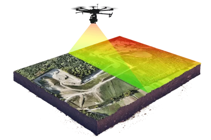
LiDAR Mapping Agencies play an important role in Scan to
BIM because LiDAR technology captures millions of accurate
measurement points within a short time. LiDAR stands for
Light Detection and Ranging. It uses laser pulses to
measure distances and create a precise 3D representation
of the scanned area.
A LiDAR survey can capture:
- Building elevations
- Floor levels
- Columns and beams
- Walls and openings
- Roof details
- Staircases
- MEP services
- Roads and site features
- Terrain levels
- Industrial equipment
- Structural elements
- Existing site obstructions
Precision Surveys lists LiDAR Survey as part of its
services and describes LiDAR as laser scanning technology
used to capture precise 3D measurements of land and
structures.
Professional LiDAR Mapping Agencies help project teams by
providing accurate point cloud data that becomes the base
for BIM modeling. Without reliable scan data, the BIM
model may not reflect the actual site condition. That is
why choosing an experienced surveying and mapping company
is important.
A good LiDAR mapping partner should understand not only
the scanning technology but also the civil engineering and
construction requirements of the project. This ensures
that the final output is useful for architects, engineers,
contractors, and owners.
How Scan to BIM Supports 3D Modeling in South India
The demand for 3D Modeling in South India is increasing
across Karnataka, Tamil Nadu, Telangana, Andhra Pradesh,
and Kerala. Cities such as Bangalore, Hyderabad, Chennai,
Coimbatore, Mysuru, Mangalore, Kochi, and Vijayawada are
seeing strong growth in construction, infrastructure,
industrial development, and real estate.
3D modeling helps project teams visualize, analyze, and
coordinate a building or site before physical work begins.
When 3D modeling is created from accurate scan data, it
becomes more reliable and practical.
Scan to BIM supports 3D Modeling in South India for:
- Architectural modeling
- Structural modeling
- MEP modeling
- As-built modeling
- Renovation planning
- Plant and industrial modeling
- Infrastructure modeling
- Quantity estimation
- Clash detection
- Facility management
- Digital twin development
For large projects, 3D modeling helps stakeholders
understand the project clearly. Instead of relying only on
2D drawings, teams can view the building digitally and
identify potential issues early. This improves
communication between architects, clients, engineers, site
teams, and consultants.
In South India, where many projects are spread across busy
urban areas and complex site conditions, Scan to BIM can
save significant time by reducing repeated manual surveys
and improving design accuracy.
Benefits of Scan to BIM Services
1. Accurate As-Built Documentation
One of the biggest advantages of Scan to BIM is accurate
as-built documentation. The model is created based on real
site scan data, which means it reflects actual dimensions
and conditions. This is highly useful for renovation,
extension, redevelopment, and facility management
projects.
2. Reduced Site Errors
Construction errors often happen due to inaccurate
drawings or assumptions. Scan to BIM reduces these errors
by providing reliable site data. When designers and
contractors work with an accurate model, they can identify
problems before work begins.
3. Faster Project Planning
Manual measurements of large or complex buildings can take
a lot of time. LiDAR scanning captures detailed
information quickly. Once the point cloud is processed,
the BIM model can support faster decision-making and
planning.
4. Better Coordination Between Teams
Architects, structural engineers, MEP consultants,
contractors, and clients can work on the same digital
model. This improves coordination and reduces
miscommunication.
5. Useful for Renovation and Retrofitting
In renovation projects, existing drawings are often
outdated or unavailable. Scan to BIM creates a reliable
digital model of the current building condition, making
renovation planning easier and safer.
6. Improved Clash Detection
BIM models can be used to identify clashes between
architectural, structural, and MEP elements. This is
especially useful for commercial buildings, hospitals,
factories, and large infrastructure projects.
7. Better Facility Management
Once the project is completed, the BIM model can be used
for maintenance, repairs, asset tracking, and future
modifications. Facility managers can use the model as a
digital reference for the building.
Industries That Need Scan to BIM Services in Bangalore
Scan to BIM Services in Bangalore are useful for many
industries and project types, including:
- Real estate developers
- Architects and design consultants
- Civil engineering companies
- Construction contractors
- Structural consultants
- MEP consultants
- Industrial plant owners
- Facility management companies
- Government infrastructure projects
- Hospitals and educational institutions
- Airports and transport infrastructure
- Warehouses and logistics parks
- IT parks and commercial buildings
Precision Surveys serves the civil engineering industry
and provides services such as land survey valuation, due
diligence technical property consultation, LiDAR services,
geotechnical assessments, flood risk assessment, and other
engineering land surveyor services.
This type of service background is highly relevant for
Scan to BIM because successful BIM modeling depends on
strong survey accuracy and technical site understanding.
Scan to BIM Workflow
Step 1: Project Requirement Study
The team first understands the purpose of the project. For
example, the requirement may be renovation modeling,
as-built documentation, MEP coordination, structural
assessment, or facility management.
Step 2: Site Visit and Scanning Plan
Before scanning, the team plans scanner locations, access
points, safety requirements, and coverage areas. Proper
planning ensures that all important areas are captured.
Step 3: LiDAR Scanning
The site is scanned using laser scanning or LiDAR
equipment. The scanner captures millions of data points
from the physical environment.
Step 4: Point Cloud Registration
Multiple scans are combined and aligned to create a
complete point cloud. This point cloud becomes the digital
base for modeling.
Step 5: BIM Model Creation
The point cloud is used to create 3D BIM models. Depending
on the requirement, the model may include architectural,
structural, MEP, or site elements.
Step 6: Quality Check
The model is checked against the scan data for accuracy.
Any missing or unclear areas are reviewed before final
delivery.
Step 7: Final Output Delivery
The final deliverables may include BIM files, 3D models,
CAD drawings, floor plans, elevations, sections, or
as-built documentation.
Why Choose Precision Surveys for Scan to BIM and LiDAR
Mapping?
Precision Surveys Pvt. Ltd. has a strong foundation in
land surveying, mapping, geotechnical investigation, and
civil engineering survey services. The company has been
serving the industry since 1995 and offers a wide range of
services including Topographical Surveys, DGPS Surveys,
Photogrammetric Surveys, LiDAR Surveys, Alignment Surveys,
Quantity Surveying, Property Valuation Services, and
Aerodrome Obstacle Surveys.
Choosing an experienced surveying partner is important
because Scan to BIM accuracy depends heavily on site
measurement quality. A team with knowledge of land
surveys, LiDAR, DGPS, topography, and infrastructure
projects can capture and process site data more
effectively.
Precision Surveys can support clients who need:
- LiDAR scanning support
- Accurate site measurement
- Point cloud data generation
- As-built survey support
- 3D modeling support
- Land and building documentation
- Civil engineering survey assistance
- Infrastructure survey support
For project enquiries, users can visit the Contact page
here:
Contact Precision Surveys
You can also explore the company's services from the
homepage:
Precision Surveys - Land Surveyor in Bangalore
Conclusion
Scan to BIM Services in Bangalore are becoming essential
for construction, renovation, infrastructure, and facility
management projects. By combining LiDAR scanning, point
cloud processing, and accurate 3D modeling, project teams
can work with real site conditions instead of relying on
assumptions or outdated drawings.
Professional LiDAR Mapping Agencies help capture accurate
physical data, while BIM specialists convert that
information into usable digital models. As the demand for
3D Modeling in South India continues to grow, Scan to BIM
will play a key role in improving planning, coordination,
construction quality, and long-term asset management.
For architects, developers, engineers, contractors, and
infrastructure companies, working with an experienced
survey partner like Precision Surveys can help improve
accuracy from the earliest stage of the project. With
decades of experience in land surveying, LiDAR services,
geotechnical investigation, and civil engineering survey
solutions, Precision Surveys is well-positioned to support
modern digital survey and modeling requirements in
Bangalore and across South India.
For enquiries, visit:
https://www.precisionsurveys.co.in/contact.html
FAQs
1. What are Scan to BIM Services in Bangalore?
Scan to BIM Services in Bangalore involve capturing
existing site or building conditions using LiDAR or laser
scanning and converting the scanned point cloud data into
a detailed 3D BIM model. These services are useful for
renovation, construction planning, as-built documentation,
MEP coordination, and facility management.
2. Why is LiDAR scanning important for Scan to BIM?
LiDAR scanning is important because it captures highly
accurate 3D measurements of buildings, land, structures,
and site features. The point cloud created from LiDAR
scanning acts as the foundation for accurate BIM modeling.
3. Who needs Scan to BIM services?
Scan to BIM services are useful for architects, builders,
real estate developers, civil engineers, structural
consultants, MEP consultants, facility managers,
industrial plant owners, and infrastructure companies that
require accurate digital building or site documentation.
4. What is the role of LiDAR Mapping Agencies?
LiDAR Mapping Agencies capture precise site data using
laser scanning technology. They help create accurate point
cloud data, which can then be used for 3D modeling, BIM
modeling, topographical surveys, infrastructure mapping,
and as-built documentation.
5. How does Scan to BIM help renovation projects?
In renovation projects, existing drawings may be missing,
outdated, or inaccurate. Scan to BIM creates a reliable 3D
model of the current building condition, helping
architects and engineers plan modifications accurately and
avoid site errors.
6. Is Scan to BIM useful for 3D Modeling in South India?
Yes. Scan to BIM is highly useful for 3D Modeling in South
India because cities like Bangalore, Hyderabad, Chennai,
Mysuru, Kochi, and Coimbatore are witnessing rapid
construction and infrastructure development. Accurate
scan-based 3D models help improve project planning and
coordination.
7. What files can be delivered after Scan to BIM?
Depending on the project requirement, deliverables may
include point cloud data, BIM models, CAD drawings, floor
plans, elevations, sections, as-built drawings, and 3D
models. The exact output depends on the scope of work.
8. Why choose Precision Surveys for LiDAR and Scan to BIM
support?
Precision Surveys has been serving the civil engineering
industry since 1995 and provides services such as land
surveying, LiDAR surveys, DGPS surveys, topographical
surveys, geotechnical investigation, photogrammetric
surveys, and other engineering survey solutions. Their
technical surveying background supports accurate data
collection for Scan to BIM and 3D modeling projects.